NavVis VLX 3 wearable mobile mapper launches
New lidar sensors generate twice the amount of data at range, for improved modelling accuracy and precision
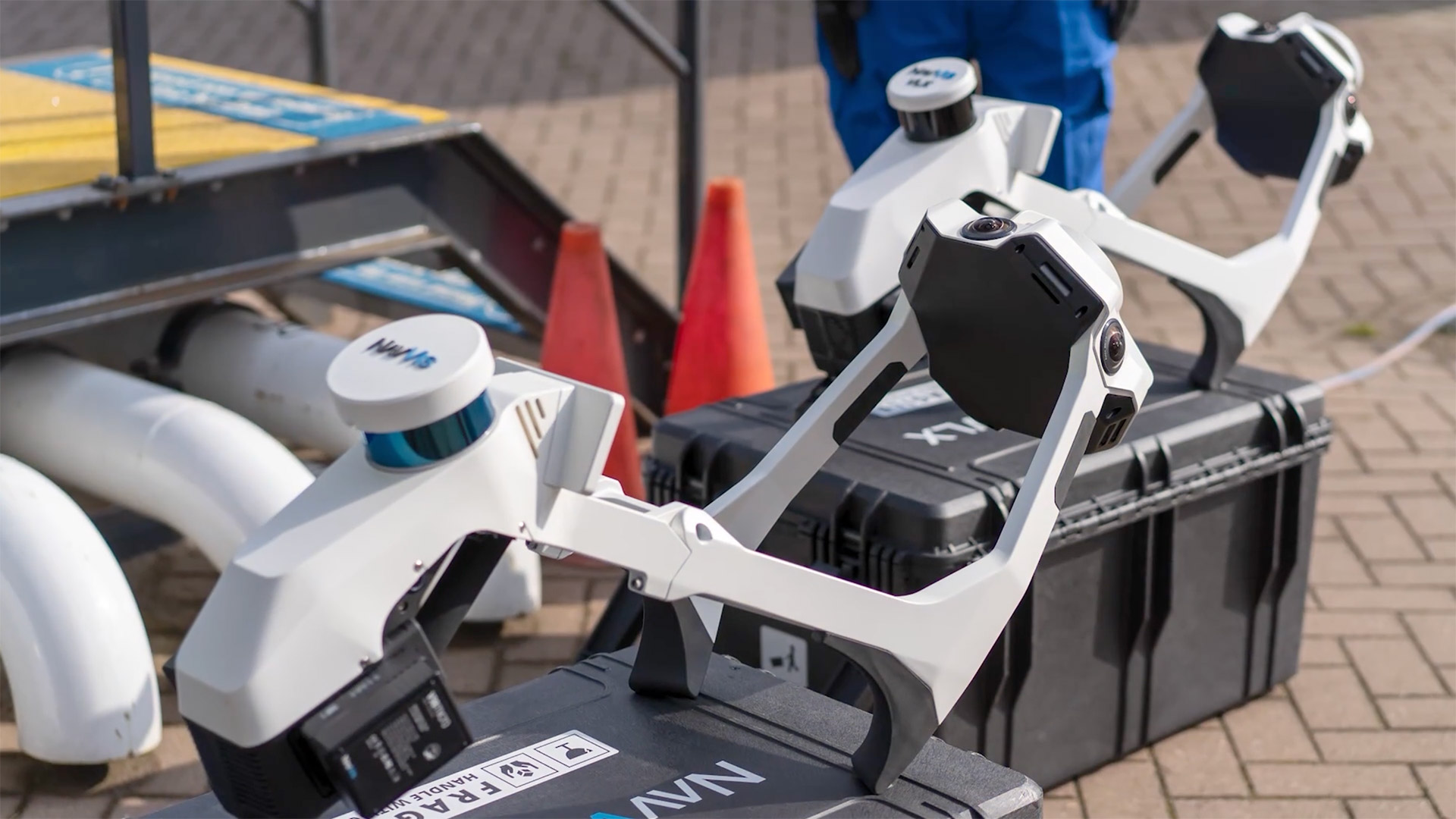
NavVis has lunched the NavVis VLX 3, the latest version of its wearable mobile mapping device, designed to capture indoor and outdoor environments with high detail.
The all-in-one device captures 3D measurements at walking pace with two new 32-layer lidar sensors in combination with SLAM software to deliver what the company describes as ‘industry-leading’ point cloud quality.
According to NavVis, the new lidar sensors generate twice the amount of data at range, with 1.2 million points per second, and increased vertical field of view, optimising the level of detail that can be extracted from the point cloud, improving modelling accuracy and precision.
“If you just look at the coverage at distance, it is truly on a completely different level,” said Dr Georg Schroth, CTO and co-founder, NavVis. “The VLX 3 will not only show details in more clarity, it will also feature an improved absolute accuracy with further reduced drift – for instance, when you scan long roads sections.
“So, from scanning civil construction work like roads and bridges to topographic surveys, the VLX 3 is going to be the new cornerstone tool that you will bring and use in any kind of project.”
Meanwhile, four cameras positioned on top of the device take high-resolution, sharp images in every direction for a complete 360º image — all without the operator appearing in the field of view.
Thanks to software updates, both the NavVis VLX 3 and NavVis VLX 2 (with its original cameras) feature an improved panoramic resolution, so users will be able to read text and other details likes cracks in more clarity.
For scanning feedback, users can monitor scanning progress in real time with a built-in touchscreen.
Other features include ‘highly realistic texturing’ and the ability to automatically detect and remove dynamic objects from point clouds during postprocessing.
According to the developers, NavVis VLX 3 is fully compatible with standard tools in the field and can capture control points in a local site coordinate system measured by both Total Stations and GNSS rovers. The device also supports national and global coordinates for ‘precise georegistration’ and alignment of datasets.
The unit itself features a hinged design that folds up and fits into a protective hard-shelled case on wheels or backpack, so that a single operator can easily transport and set up. It comes fully equipped with grip pads, shoulder pads, and stabilizing belt.
In addition to launching the VLX 3, NavVis has announced that it will continue production of the VLX 2 and has reduced the price accordingly.
The post NavVis VLX 3 wearable mobile mapper launches appeared first on AEC Magazine.
Powered by WPeMatico